

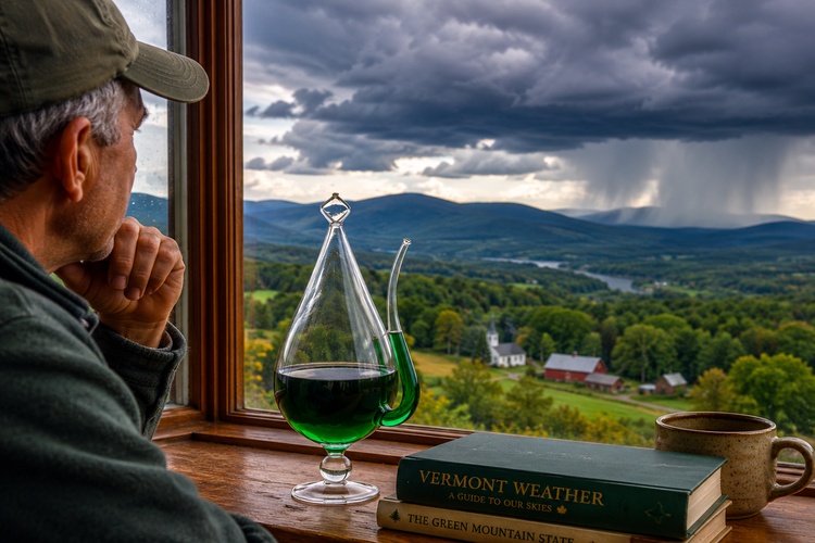
Most Vermonters have experienced it.
The forecast calls for sunshine and temperatures in the mid-70s. Farmers plan field work. Gardeners schedule planting. Families organize outdoor gatherings. Then the day arrives and temperatures never climb out of the 50s. Low clouds linger, drizzle develops, and the promised warmth never materializes.
When that happens, it is easy to assume the forecast was simply wrong. But weather forecasting is often far more complicated than many people realize—especially in Vermont.
Forecasting Is About Probability, Not Certainty
Modern weather forecasting combines observations from satellites, weather stations, aircraft, weather balloons, radar systems, and ocean buoys with powerful computer models that simulate the atmosphere.
Meteorologists analyze enormous amounts of data and compare multiple forecast models to estimate what is most likely to happen.
The important word is “likely.”
A forecast is not a guarantee. It is an assessment of probabilities based on the best available information at a particular moment. As new data arrives, forecasts are updated because the atmosphere itself is constantly changing.
Many forecasts are presented with a level of certainty that can make them seem more precise than they actually are. A prediction of 74 degrees and sunny may really represent the most likely outcome among several possibilities.
🍁 Make a One-Time Contribution — Stand Up for Accountability in Vermont 🍁
Understanding Common Weather Terms
Weather forecasts often include technical terms that many people hear regularly but may not fully understand.
High pressure refers to an area where air is sinking toward the ground. Sinking air tends to suppress cloud formation, which is why high-pressure systems are often associated with fair weather.
Low pressure is the opposite. Air rises, cools, and condenses into clouds and precipitation. Many storms develop around low-pressure systems.
A cold front is the leading edge of colder air moving into an area. Cold fronts often bring showers, thunderstorms, gusty winds, and rapid temperature changes.
A warm front occurs when warmer air moves over cooler air. Warm fronts often produce widespread clouds and steady precipitation.
Humidity describes the amount of moisture in the air. Dew point is a related measurement that indicates the temperature at which moisture would begin condensing into dew. Many meteorologists consider dew point a better measure of how humid it feels than relative humidity alone.
Barometric pressure measures the weight of the atmosphere pressing down on Earth’s surface. Rising pressure often signals improving weather, while falling pressure can indicate an approaching storm system.
Why Wind Direction Matters
One of the most useful forecast details is also one of the most misunderstood.
Wind direction refers to where the wind is coming from, not where it is going. A north wind blows from the north toward the south. A southwest wind blows from the southwest toward the northeast.
Meteorologists pay close attention to wind direction because it helps reveal what kind of air mass is moving into an area. In general, south and southwest winds often bring warmer, more humid air into Vermont. North and northwest winds frequently deliver cooler, drier air from Canada.
Wind direction can also influence cloud cover, temperatures, and precipitation. A shift in wind direction ahead of a weather system may signal changing conditions hours before rain or storms arrive.
In Vermont, local geography can make wind effects even more noticeable. Lake Champlain, mountain ridges, valleys, and elevation changes can all alter local wind patterns. As a result, neighboring towns may experience different temperatures, cloud cover, or rainfall even when they are only a few miles apart.
For anyone planning a farmers market, drying hay, protecting crops from frost, scheduling an outdoor event, or simply deciding whether to bring a jacket, wind direction often provides valuable clues about what the day may bring.
Radar, Doppler Radar, and Forecast Models
Weather radar detects precipitation by sending out radio waves and measuring the energy reflected back from rain, snow, sleet, or hail.
Doppler radar adds another layer of information by measuring the movement of precipitation particles. This allows meteorologists to identify wind patterns within storms and detect features such as rotation that could indicate severe weather.
Forecast models are computer simulations that attempt to predict how the atmosphere will evolve. Different models use slightly different methods and assumptions, which is why forecasts sometimes vary from one source to another.
Meteorologists typically compare multiple models rather than relying on a single prediction.
What Does a 40 Percent Chance of Rain Actually Mean?
One of the most misunderstood forecast terms is the probability of precipitation.
A 40 percent chance of rain does not mean it will rain for 40 percent of the day. It does not necessarily mean 40 percent of an area will receive rain.
Instead, it represents the probability that measurable precipitation will occur at a given location during the forecast period.
The higher the percentage, the greater the confidence that precipitation will occur.
Watches and Warnings Are Not the Same Thing
Severe weather alerts also cause confusion.
A watch means conditions are favorable for severe weather to develop. People should stay aware and monitor updates.
A warning means severe weather is occurring or imminent. Protective action may be needed immediately.
The difference is simple: a watch means “be prepared,” while a warning means “take action.”
Why Vermont Is So Difficult to Forecast
Vermont presents unique forecasting challenges that do not exist in many flatter parts of the country.
The Green Mountains create dramatic elevation changes over relatively short distances. Air moving across mountain terrain can rise, cool, and form clouds or precipitation in one location while neighboring areas remain dry.
Valleys can also trap cold air overnight, a process known as cold-air pooling. As a result, temperatures in one town may fall into the 30s while nearby hilltops remain significantly warmer.
Lake Champlain introduces another variable. The lake can influence temperatures, cloud development, wind patterns, and precipitation near the shoreline.
Even small differences in cloud cover can significantly affect temperatures. If morning clouds linger two hours longer than expected, temperatures may end up 10 to 15 degrees cooler than forecast.
Why Neighboring Towns Can Have Different Weather
A storm can be forecast correctly at the regional level while producing very different local conditions across Vermont.
One town may experience heavy rain while another receives only scattered showers. A frost advisory may verify in a valley location while nearby higher elevations stay above freezing.
These differences matter for farmers deciding when to cut hay, gardeners protecting sensitive plants, vendors preparing for farmers markets, organizers planning outdoor events, and drivers navigating changing road conditions.
In many cases, the forecast is not necessarily wrong. The atmosphere is simply responding to local terrain features that can dramatically alter weather over short distances.
Reading Pressure Trends Like a Meteorologist
Barometric pressure can provide useful clues about changing weather.
Rapidly falling pressure often indicates that a storm system is approaching. Steadily rising pressure typically signals improving conditions.
While pressure trends alone cannot predict specific weather outcomes, they help meteorologists understand how atmospheric systems are evolving and whether conditions are becoming more stable or more unsettled.
Understanding Risk, Not Predicting the Future
Weather forecasting is often described as predicting the future, but that oversimplifies the process.
Meteorologists are not making guarantees. They are evaluating atmospheric conditions, analyzing probabilities, and communicating risk based on the best available data.
In a state as geographically complex as Vermont, even small shifts in timing, cloud cover, wind direction, or storm track can produce dramatically different outcomes from one town to the next.
The goal of forecasting is not certainty. It is helping people make informed decisions with the information available.
FYIVT is exploring ways to provide more Vermont-focused weather information, educational resources, and practical forecasting tools to help readers better understand local conditions and make informed decisions throughout the year.
Dave Soulia | FYIVT
You can find FYIVT on YouTube | X(Twitter) | Facebook | Instagram
#fyivt #VermontWeather #VermontNews #WeatherEducation
Support Us for as Little as $5 – Get In The Fight!!
Make a Big Impact with $25/month—Become a Premium Supporter!
Join the Top Tier of Supporters with $50/month—Become a SUPER Supporter!


Leave a Reply