

Part 1: What the Legislature Built
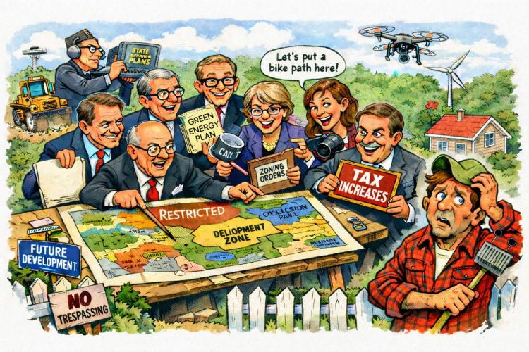
On Wednesday, January 28, the Senate Natural Resources & Energy Committee held an informational meeting on Vermont’s new land-use planning framework. Representatives from multiple state agencies and planning organizations appeared before senators to explain how a recently enacted system will guide where housing is built, where growth is encouraged, and where land is expected to remain rural or conserved.
At first glance, the topic — “future land use planning” — sounds abstract. But future land use is not theoretical. It is the framework that determines which towns are expected to grow (and not), what infrastructure the state will support, and what property owners will find encouraged, discouraged, or increasingly costly to pursue on their own land.
What was presented is a system that is already operating: regional plans are being rewritten, land is being classified across entire counties, and state approvals are beginning to lock those classifications into place. For many Vermonters, this was the first time they realized that decisions about the long-term use of their property are already being mapped.
To understand why those maps are generating alarm — and why lawmakers were briefed on them now — it helps to understand what the Legislature has already built.
🍁 Make a One-Time Contribution — Stand Up for Accountability in Vermont 🍁
Act 181: Regional planning rebuilt from the ground up
In 2024, the Legislature passed Act 181, a sweeping rework of Vermont’s regional planning system.
At the center of Act 181 is a requirement that all 11 Regional Planning Commissions (RPCs) update their regional plans using a standardized set of Future Land Use (FLU) categories. These categories are the same statewide, by design, so that individual regional maps can be stitched together into a single, coherent picture of Vermont’s future land use.
The categories include multiple types of “growth” areas — such as downtowns, village centers, and planned growth areas — as well as large-scale categories like Rural and Rural Conservation.
This is not zoning. Regional plans do not directly override municipal bylaws. But Act 181 elevates regional plans into a much more consequential role than they previously held.
LURB: The new gatekeeper
Act 181 also shifted approval authority for regional plans to the Land Use Review Board (LURB).
RPCs draft regional plans and FLU maps. But those plans do not become operative until LURB approves them. That approval is not symbolic. It is the moment when a regional plan becomes the state-recognized framework for land use planning in that region.
LURB is a small, appointed board. Under Act 181, it has final authority to approve or reject regional plans, including their Future Land Use maps.
Once LURB approves a plan, downstream consequences follow automatically.
What flips when a regional plan is approved
When LURB approves a regional plan under Act 181, several things happen at once:
- State designations (such as downtowns and village centers) are no longer applied for town by town. They are derived directly from the approved regional FLU map.
- Certain Act 250 jurisdiction changes for housing can apply within mapped growth areas, if a municipality opts in.
- Housing targets assigned by the Department of Housing and Community Development (DHCD) are expected to be accommodated primarily within those mapped growth areas.
In other words, LURB approval turns planning categories into operational assumptions. The map becomes the baseline for future regulatory, funding, and policy decisions.
If the future land use map largely reflects the present, then the “aspiration” embedded in the system is status quo — not transformation.
What planners are mapping right now
This is where the abstract system meets the real world.
Across Vermont, RPCs are actively drafting and revising FLU maps under Act 181. In multiple regions, including Rutland County, those draft maps show large portions of land classified as “Rural Conservation.”
In the Rutland Region’s December 2025 draft map, roughly 58–59% of the county is categorized as Rural Conservation — a sharp increase from earlier planning maps. In many individual towns, a majority of land area now falls under that category.
Planners have been clear in public meetings:
Rural Conservation is not the same thing as a conservation designation.
It does not, by itself, impose new restrictions.
But it is a classification — and classifications matter. They signal where growth is discouraged, where conservation is presumed, and where future policy choices are likely to land.
RPC meeting transcripts show planners openly acknowledging that this mapping is alarming to landowners, and that once LURB approves a plan, local discretion narrows.
Housing targets are already baked into the system
Act 181 does not exist in isolation. Housing targets are now a required element of both regional and municipal planning.
DHCD assigns housing growth targets by region. RPCs are required to disaggregate those targets by municipality and ensure their regional plans can accommodate them — primarily within mapped growth areas.
Those targets vary dramatically by region. Chittenden County’s housing growth expectation is several times higher than most other counties, while many regions face growth targets in the low single-digit percentages.
At this stage, the significance of that disparity is not being debated here. The point is procedural: housing targets are being routed into a planning framework that is already classifying land for growth and conservation.
Act 59: The conservation plan that isn’t finished
This is the missing piece.
In June 2023 — a year before Act 181 — the Legislature passed Act 59, committing Vermont to the widely cited 30×30 and 50×50 conservation goals. Act 59 required the Vermont Housing and Conservation Board (VHCB), in consultation with the Agency of Natural Resources, to produce a statewide conservation implementation plan by ***December 31, 2025***.
That plan was supposed to define:
- what conservation priorities actually are,
- how Vermont Conservation Design would be implemented,
- how landowner input would be incorporated,
- and how conservation would coexist with working lands and rural economies.
The October 2025 Draft Framework for the Vermont Conservation Plan makes clear that this work is still underway. The document describes an initial framework and outlines continued listening sessions and drafting, with finalization projected into 2026.
At the same time, Act 181’s land-use maps are already classifying large portions of the state as Rural Conservation through regional planning and LURB review — effectively putting the map before the plan.
In practical terms, conservation categories are being applied on official planning maps before the Legislature’s own conservation framework has been completed or explained to the public.
Executive action accelerating growth decisions
At the same time the Legislature was restructuring land-use planning, Governor Phil Scott issued Executive Order No. 06-25 directing state agencies to identify underutilized state-owned properties suitable for housing development, with the goal of offloading or repurposing them to increase housing supply.
That order presumes the existence of a growth framework. It relies on the same planning categories and designations created under Act 181 to determine where housing development is appropriate.
Taken together, legislative and executive actions show that growth decisions are not theoretical. They are already being operationalized.
“Aspirational” maps — or a snapshot of permanence?
During regional planning discussions, officials have emphasized that Future Land Use maps are intended to be aspirational — a picture of where a region hopes to go, not a binding statement of current conditions.
Yet planners themselves have noted a tension in that framing. In one regional planning commission discussion, the commission’s executive director observed that the draft future land use map looks less like an aspirational vision and more like a snapshot of existing conditions — with large rural areas remaining rural and growth largely confined to places that already have it.
Taken at face value, that observation raises a basic question: if the future land use map largely reflects the present, then the “aspiration” embedded in the system is status quo — not transformation. For landowners whose property is newly classified as Rural Conservation, that distinction matters. A map that reflects “what already is” also signals what the state expects to remain unchanged.
That expectation becomes more consequential once the map is reviewed and approved at the state level.
Why this matters
Viewed in isolation, each of these actions can be explained. Together, they form a system.
Vermont enacted a conservation mandate in 2023. It enacted a land-use framework in 2024. That framework is now being used to classify land across entire counties, route housing targets, and guide state action — before the conservation plan meant to define priorities and landowner impacts has been completed.
For towns and property owners, this is the moment when the future envelope of what will be encouraged, discouraged, or presumed is being drawn.
The next question is what this system means economically — and who bears the costs.
That’s where Part 2 begins. (stay tuned)
Dave Soulia | FYIVT
You can find FYIVT on YouTube | X(Twitter) | Facebook | Parler (@fyivt) | Gab | Instagram
#fyivt #vtleg #landuse #vermontfuture
Support Us for as Little as $5 – Get In The Fight!!
Make a Big Impact with $25/month—Become a Premium Supporter!
Join the Top Tier of Supporters with $50/month—Become a SUPER Supporter!


Leave a Reply to Karen RhodesCancel reply