

As the state pours money into flood resilience, the historical record and the latest science complicate a familiar story.
A familiar disaster
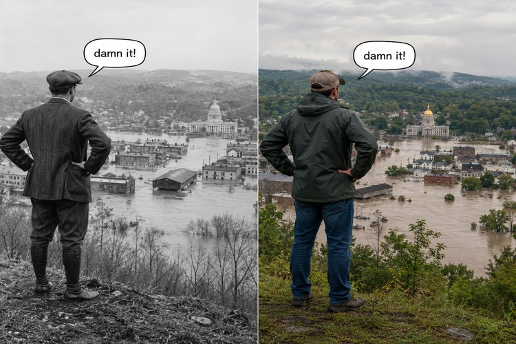
When floodwaters swallowed downtown Montpelier in July 2023, the scenes felt unprecedented. They were not. The Winooski River crested at 21.35 feet that day — more than two feet above Tropical Storm Irene in 2011, but still nearly six feet shy of the record set in November 1927, when the same river ran through the same capital and killed dozens.
Catastrophic flooding is among the oldest facts of Vermont life. The National Weather Service ranks the state’s four worst flood disasters, in order, as 1927, Irene, 1869 and 1938 — three of them more than 85 years ago. The Vermont Historical Society counts more than 20 floods in the past two centuries. Vermonters once called the 1927 disaster a “once in a century” event; Irene proved them wrong 84 years later.
The 1927 benchmark
The 1927 flood remains the benchmark. Heavy October rains had saturated the ground when a tropical system stalled over the Green Mountains in early November, dropping nearly 10 inches in places. Eighty-four people died, including Lt. Gov. S. Hollister Jackson, who drowned trying to escape his car. More than 1,200 bridges were destroyed. The disaster prompted the federal flood-control dams at Wrightsville, Waterbury and East Barre that still guard the Winooski basin today — and that, by the state’s own account, came within a few feet of being overtopped in 2023.
🍁 Make a One-Time Contribution — Stand Up for Accountability in Vermont 🍁
Built in the valleys
The reason the same towns flood again and again is written into the landscape. Vermont is among the most forested and mountainous states in the country — roughly three-quarters woods, with about 88 percent of its land below 1,950 feet, according to U.S. Geological Survey figures. The flat, buildable ground sits almost entirely in narrow river valleys. When settlers laid out towns in the 18th and 19th centuries, those valleys offered the only practical sites: water power for grist, saw and textile mills, river transport, level land and fertile floodplain soil. The mills are gone, but the downtowns they spawned — Montpelier, Barre, Waterbury, Brattleboro, Johnson — remain wedged against the rivers that built them.
What the maps miss
There is a wrinkle in how that risk is usually described. Vermont’s Department of Environmental Conservation notes that the state’s most common flood hazard is not water rising over its banks but “fluvial erosion” — rivers physically tearing out roads, bridges and buildings as they move. And much of the damage, the agency says, occurs outside the Federal Emergency Management Agency’s mapped flood zones, in areas officially rated low-risk.

More rain, but not always bigger floods
That brings the historical record into tension with the modern framing. State officials and resilience advocates routinely describe flood hazards as “increasing,” and the science behind that claim is real — but more specific than the shorthand suggests. The University of Vermont’s 2021 Vermont Climate Assessment found annual precipitation up about 21 percent since the early 1900s, with the state now seeing roughly 2.4 more days of heavy precipitation per year than in the 1960s. The signal, researchers stress, shows up not as steady drizzle but as heavier, more concentrated downpours. The broader Northeast has logged the largest increase in heavy precipitation of any U.S. region, with the amount of rain falling in the heaviest 1 percent of events up by 55 to 71 percent since the late 1950s, according to the National Climate Assessment.
More rain, however, has not translated cleanly into bigger floods. Peer-reviewed USGS research has repeatedly found that while floods have grown more frequent in New England, the trend in flood magnitude — how high the peaks actually crest — is weak and statistically mixed. A widely cited 2016 study in Geophysical Research Letters found no coherent national pattern and few significant increases in peak flows; a 2022 analysis found no significant rise in the frequency of the largest floods in the Northeast. Vermont’s own gage records bear this out: per a 2025 USGS report, the 1927 flood still holds the peak of record at eight long-running streamgages, Irene at 25 and the 1973 flood at 10. The devastating 2023 event set records at only 11 gages — none of which existed in 1927.
Two laws, one paradox
Against that backdrop, the state has enacted two major 2024 laws. Act 121, the Flood Safety Act, will require permits to develop in river corridors starting in 2028 and sets state flood-hazard building standards. Act 181, the long-debated overhaul of Act 250, shifts land-use review toward a location-based system that eases development in designated downtowns and village centers while adding scrutiny to rural and forested uplands.
Critics note an apparent paradox: many of the village centers the state wants to densify sit in the same flood-prone valleys. The laws partly anticipate this — Act 181’s housing exemptions specifically exclude mapped river corridors and flood hazard areas, and the state frames forested uplands as natural flood buffers worth protecting rather than safer building sites. But the tension is real and, in places, acknowledged by officials themselves. In Waterbury, where leaders are weighing housing at the edge of a 100-year flood zone, the outgoing selectboard chair recently conceded that “inherent tension is real.”
That, more than any single storm, may define Vermont’s next decade: not whether the valleys flood — the record says they will — but what the state decides to build in them.
Dave Soulia | FYIVT
You can find FYIVT on YouTube | X(Twitter) | Facebook | Instagram
#fyivt #Vermont #Flooding #Act121
Support Us for as Little as $5 – Get In The Fight!!
Make a Big Impact with $25/month—Become a Premium Supporter!
Join the Top Tier of Supporters with $50/month—Become a SUPER Supporter!


Leave a Reply